Risk intelligence per la sicurezza degli spazi pubblici
Stai per accedere a IGUDAR
Scorri per continuare
Risk intelligence per la sicurezza degli spazi pubblici
Lo studio di sicurezza
completo in 48
ore.
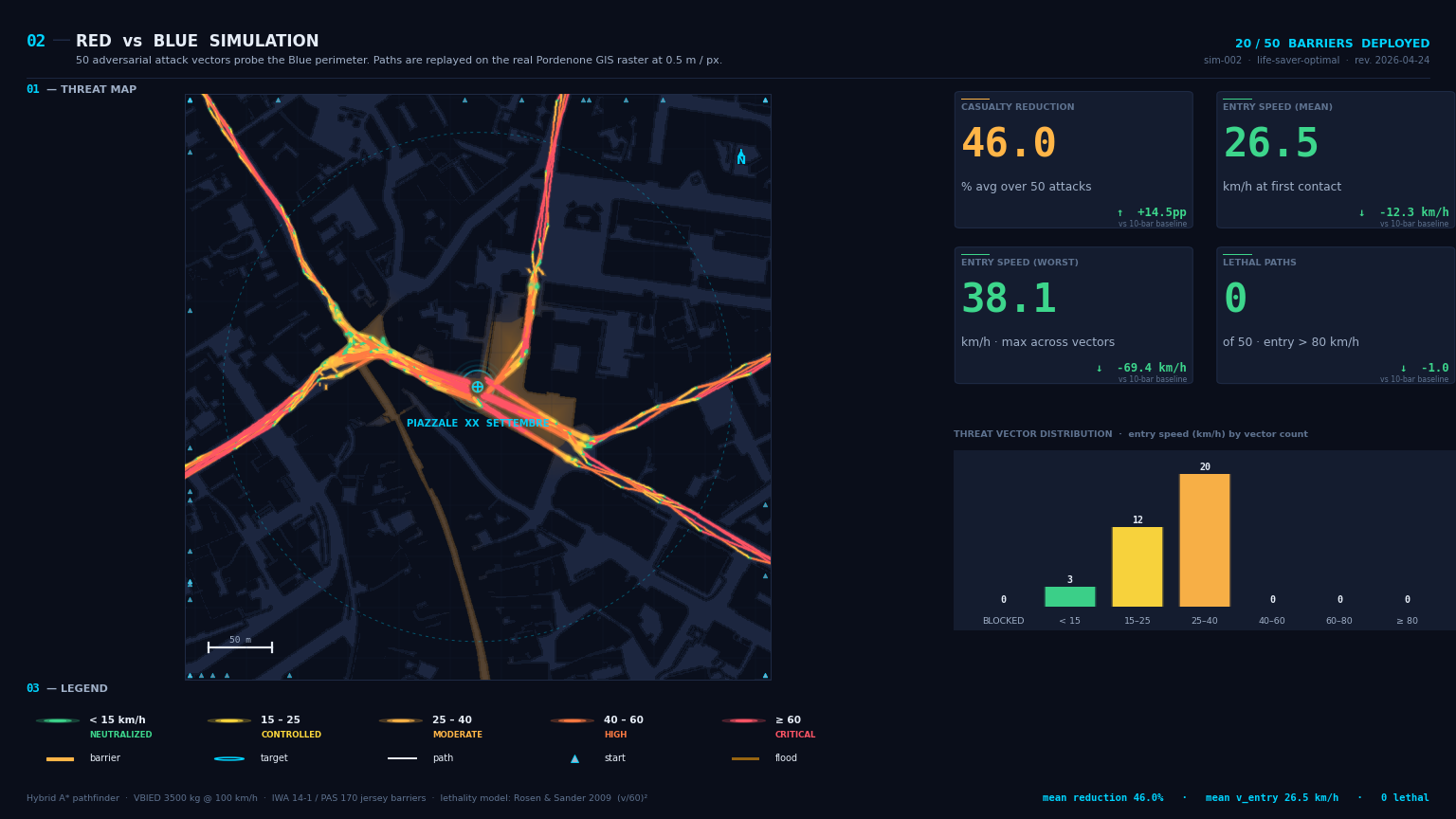
IGUDAR genera lo studio quantitativo completo di safety & security di un evento o di uno spazio pubblico. L'intelligenza artificiale conduce l'analisi, i numeri arrivano dalla fisica reale. Settimane di consulenza specialistica diventano ore di calcolo — e il professionista abilitato firma il risultato.